Grocery Store Accessibility
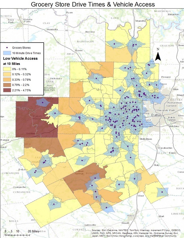
The first map is an interactive map that shows all of the supermarkets for all 13 counties that Tarrant Area Food Bank serves. Around each supermarket is a 10 mile drive time buffer. This map also shows the percentage of people with low vehicle access at 10 miles. If an area has no supermarkets near it and it has low vehicle access, it makes it difficult to obtain nutritious food. Food deserts are associated with supermarket shortages. The area most in need is the county of Palo Pinto. It has a high low vehicle access only two supermarkets in its county. The second map also shows all of the supermarkets for all 13 counties that TAFB serves. Around each supermarket is a 1 mile walking buffer. Low income and low access areas are red. Residents of a food desert area do not always have the ability to utilize cars, so they travel several miles on foot or use public transit.